
Natural and environmental hazards that the Earth are Facing
Large areas are subject to extreme weather such as tropical
cyclones,
hurricanes, or
typhoons that dominate life in those areas. Many places are subject to
earthquakes,
landslides,
tsunamis,
volcanic eruptions,
tornadoes,
sinkholes,
blizzards, floods, droughts, and other calamities and disasters.
Many localized areas are subject to human-made
pollution of the air and water,
acid rain and toxic substances, loss of vegetation (
overgrazing,
deforestation,
desertification), loss of wildlife, species extinction,
soil degradation, soil depletion, erosion, and introduction of
invasive species.
According to the
United Nations, a scientific consensus exists linking human activities to
global warming due to industrial carbon dioxide emissions. This is predicted to produce changes such as the melting of glaciers and ice sheets, more extreme temperature ranges, significant changes in weather and a
global rise in average sea levels.
[144] [
edit] Human geography
Main article:
Human geography See also:
World 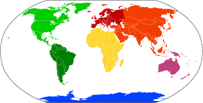 Cartography
, the study and practice of map making, and vicariously geography, have historically been the disciplines devoted to depicting the Earth.
Surveying, the determination of locations and distances, and to a lesser extent
navigation, the determination of position and direction, have developed alongside cartography and geography, providing and suitably quantifying the requisite information.
Earth has approximately 6,803,000,000 human inhabitants as of December 12, 2009.
[145] Projections indicate that the
world's human population will reach seven billion in 2013 and 9.2 billion in 2050.
[146] Most of the growth is expected to take place in
developing nations. Human
population density varies widely around the world, but a majority live in
Asia. By 2020, 60% of the world's population is expected to be living in urban, rather than rural, areas.
[147] It is estimated that only one-eighth of the surface of the Earth is suitable for humans to live on—three-quarters is covered by oceans, and half of the land area is either desert (14%),
[148] high mountains (27%),
[149] or other less suitable terrain. The northernmost permanent settlement in the world is
Alert, on
Ellesmere Island in
Nunavut, Canada.
[150] (82°28′N) The southernmost is the
Amundsen-Scott South Pole Station, in Antarctica, almost exactly at the South Pole. (90°S)
The Earth at night, a composite of
DMSP/OLS ground illumination data on a simulated night-time image of the world. This image is not photographic and many features are brighter than they would appear to a direct observer.
Independent sovereign
nations claim the planet's entire land surface, except for some parts of Antarctica and the odd
unclaimed area of
Bir Tawil between
Egypt and
Sudan. As of 2007 there are
201 sovereign states, including the 192
United Nations member states. In addition, there are 59
dependent territories, and a number of
autonomous areas,
territories under dispute and other entities.
[10] Historically, Earth has never had a
sovereign government with authority over the entire globe, although a number of nation-states have striven for
world domination and failed.
[151] The
United Nations is a worldwide
intergovernmental organization that was created with the goal of intervening in the disputes between nations, thereby avoiding armed conflict.
[152] It is not, however, a world government. The U.N. serves primarily as a forum for international diplomacy and
international law. When the consensus of the membership permits, it provides a mechanism for armed intervention.
[153] The first human to orbit the Earth was
Yuri Gagarin on April 12, 1961.
[154] In total, about 400 people visited
outer space and reached Earth orbit as of 2004, and, of these,
twelve have walked on the Moon.
[155][156][157] Normally the only humans in space are those on the
International Space Station. The station's crew, currently six people, is usually replaced every six months.
[158] Humans traveled the farthest from the planet in 1970, when the
Apollo 13 crew was 400,171 km away from Earth.
[159][160]


